Walking Routes
Lough Boora Discovery Park offers trails ranging from a short stroll to longer treks to take you through our diverse amenities. All routes start and end at the Visitor Centre, with a level walking landscape that can be enjoyed by all age groups and abilities.
Walking Routes

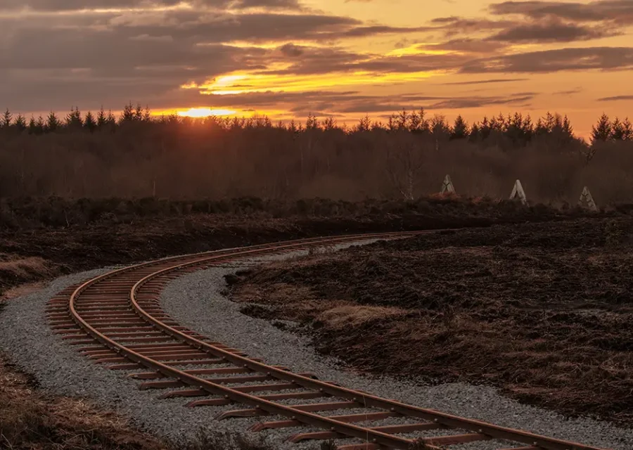
Sculpture Park Route (3.3km)
Sculpture Park Route (3.3km)
Distance: 3.3km
Difficulty Level: Easy
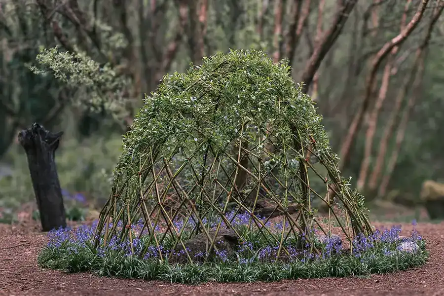
Where art meets nature – Lough Boora is home to some of the most innovative land and environmental sculptures in Ireland. The artists, inspired by the rich natural and industrial legacy of the bog lands, have created a series of large-scale sculptures that are now part of the park’s permanent collection.
As a paradise for outdoor enthusiasts interested in its unique flora and wildlife, the Sculpture Park’s route is enhanced by 24 innovative works of art that dramatically change the landscape with varying contrast depending on the weather, throughout the seasons and over time.
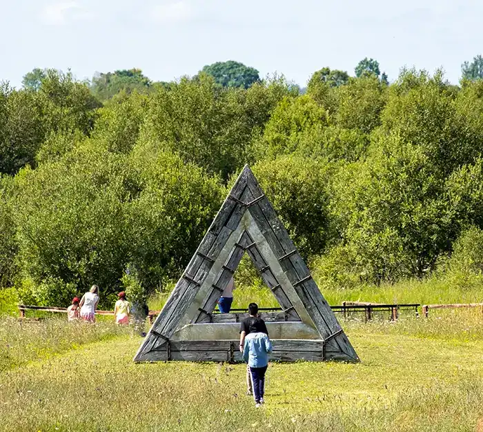
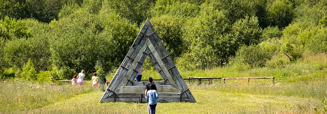
Cross the wooden footbridge and follow the sandy path for 200m to cross over the embankment and descend to the Sculpture Park. Take the narrow sandy track which veers to the right around the back of the large stone Boora Pyramid.
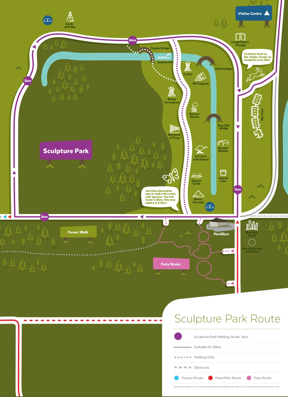
From the pyramid continue along the sandy track past a series of unusual sculptures, with the end of this section marked by a metal footbridge over Crooked Brook.
An old peat train is permanently parked high on an embankment, set against the imposing Slieve Bloom Mountains.
Look out for the:
- Sculptures; and
- Slieve Bloom Mountains.

Mesolithic Route (9.3km)
Mesolithic Route (9.3km)
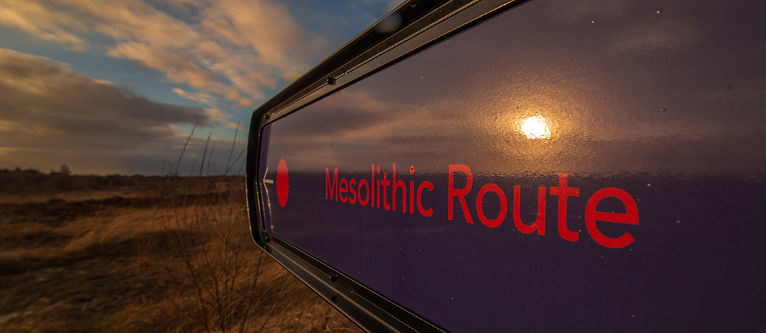
Distance: 9.3km
Difficulty Level: Moderate
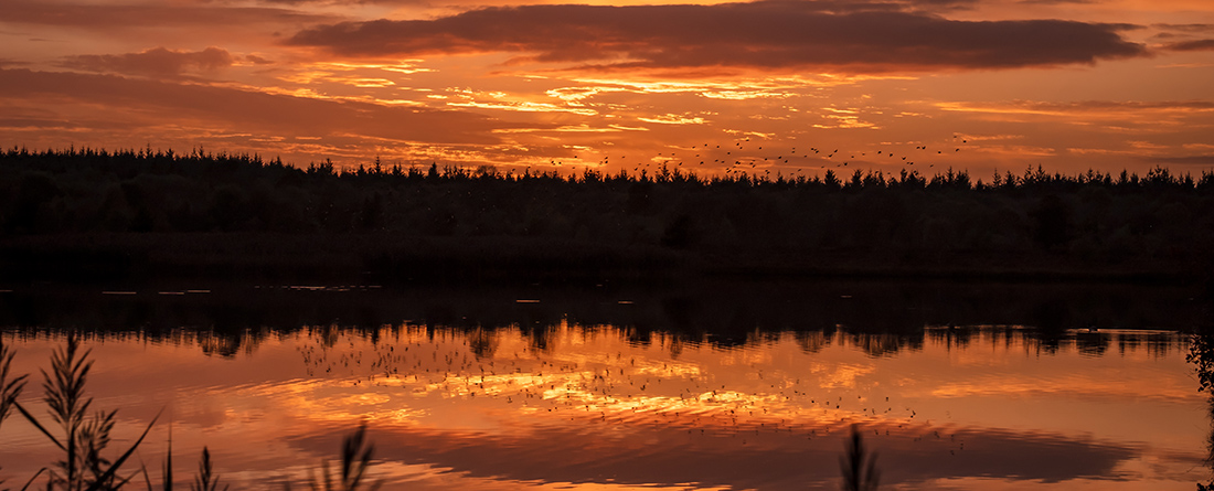
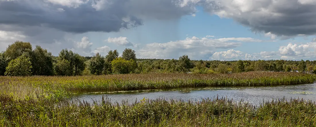
This walk is one of the longer routes and combines the Leabeg Wetland and Mesolithic Site trails in a 5km circular journey.
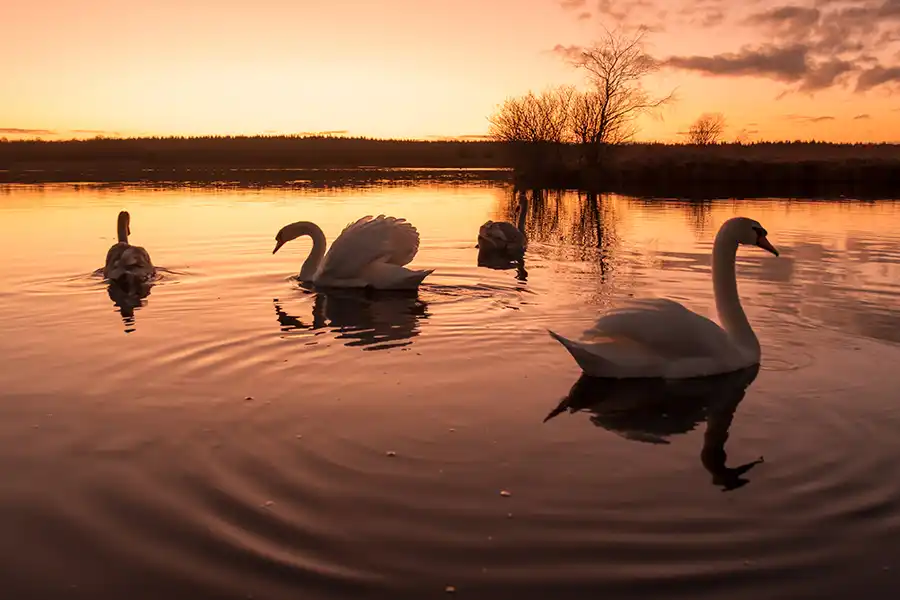
The Leabeg Wetland section of the walk does not have any way-markers and should not be attempted during the Winter or early Spring due to flooding. It is a site of National Importance for Whooper Swans and attracts migrant birds during the cooler seasons. When the site dries out in Spring, it gives rise to rich grassland. Purple Moor-grass, Yorkshire Fog and Soft Rush provide cover for ground nesting birds such as the Skylark and Meadow Pipit and smaller mammals, including the hares and the hunting foxes.
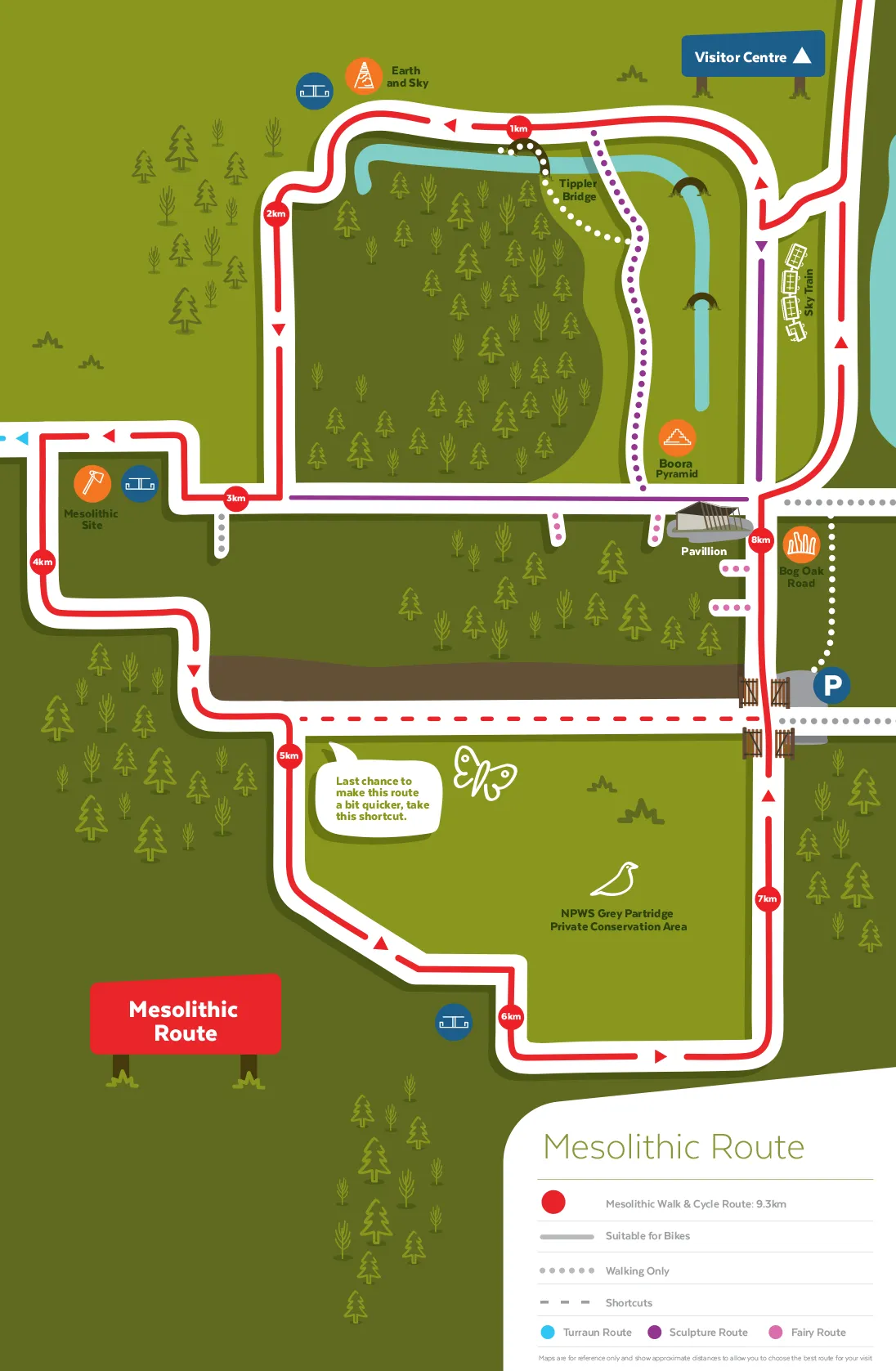
The route follows the southern shore of Lough Boora before veering north after crossing the old railway embankment and following the eastern bank of the canal known locally as the canoe course. Upon reaching the end of the canal, the trail runs south along a ride-line in the forestry and then turns west along a broad, peat access road which leads to the Mesolithic Site.
Look out for the:
- Whooper Swans;
- Purple Moor-grass;
- Skylark;
- Hares;
- Foxes; and
- Mesolithic Site.

Finnamore Lakes Route (11.7km)
Finnamore Lakes Route (11.7km)
Distance: 11.7km
Difficulty Level: Moderate
The Finnamore Lakes Route consists of Finnamores Upper (nearest to R357) and Lower, which are situated 16km to the west of Tullamore on the right (south) of the R357 Boora road, which links Cloghan village to the N52 at Blue Ball.
The lime-rich surface soil surrounding Finnamore’s Lake Lower was excavated during its construction. The fact that it consists largely of lake marl makes it a difficult substrate for plants to grow on particularly as it bakes hard during the Summer.
Swallows, House Martins and Sand Martins swoop over the lake whilst Wheatear and Common Sandpiper may be seen on the shore and in the surrounding grassland. During the Winter large numbers of Golden Plover and Lapwing gather in the wetlands and both Mute and Bewick’s Swans visit the lakes. Look out for the Black-tailed Skimmer and Keeled Skimmer, two dragonflies considered to have a local distribution in Ireland, and the many damselflies that can be seen near the lakeshore.
Starting at the wooden bridge that links the shore to a long, narrow island, this short, circular walk skirts the shore of Finnamore’s Lake Lower passing between the lake and the wetland immediately north of it.
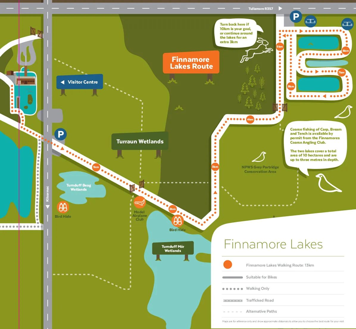
Look out for the:
- Island;
- Swallows;
- Wheatear;
- Golden Plover;
- Mute Swans;
- Dragonflies; and
- Damselflies.

Turraun Route (15.8km)
Turraun Route (15.8km)
Distance: 15.8km
Difficulty Level: Easy
The Turraun walking path is the longest route available in the park and on the Pollagh side of the Turraun Wetland. Turraun has been out of peat production longer than any of any of the park’s other sites and, having had longer to develop, is the most diverse in terms of both habitats and the number of species present.
At the beginning, the path passes through an open area which is quite wet in Winter, the insectivorous Round-leaved Sundews can be found to the right of the path to the bird hide and the yellow spikes of Bog Asphodel are visible in July. In Summer, this is a good area to see dragonflies and damselflies including the Brown Hawker, Red Darter and Banded Demoiselle.
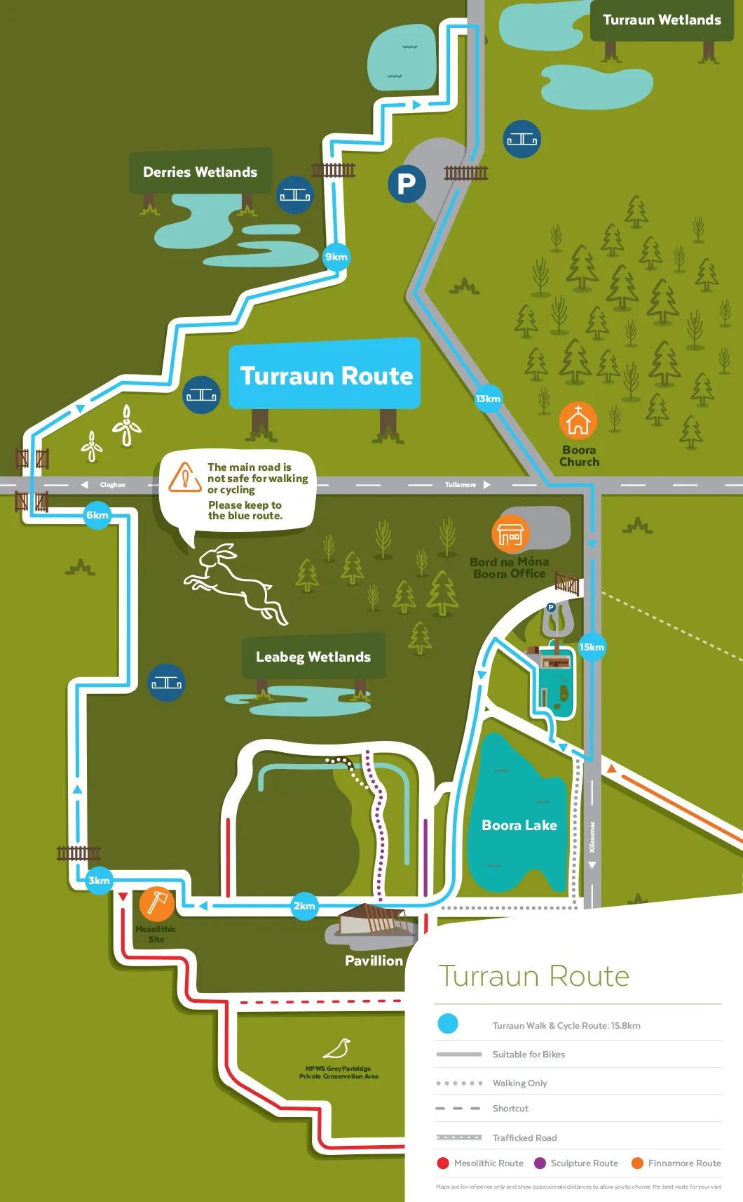
Follow the gravel road toward Pollagh (north east) for approximately 200m, before turning right (east) down the gravel path that leads off the access road. At the fork in the path, turn left to head through the birch-willow woodland and a knoll called Cocta Hill. The gravel route meanders toward the wetlands before rejoining the original path allowing you to retrace the first part of the walk and return to the starting point.
Look out for the:
- Round-leaved Sundews;
- Bog Asphodel;
- Dragonflies; and
- Damselflies.